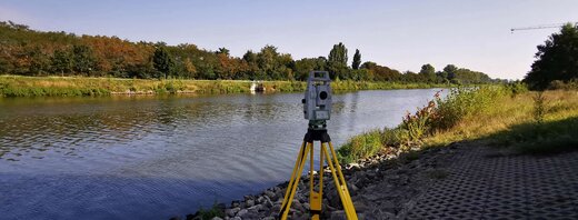
Surveys of water bodies - We take care of all the planning
For more than 30 years, GEO-METRIK has been surveying just about everything that flows through Germany. the Spree, the Elbe and the Isar, not forgetting dams, quarry ponds, gravel pits and structures such as weirs, sluices or bridges.
Surveys of water bodies with their data on the shape and depth of the water body serve here as a basis for a wide range of purposes. These range from covering pipelines and as-built documentation to the creation of digital terrain models, the implementation of hydronumerical modelling/simulations, right up to the database for the creation of flood hazard maps.
We can always rely here on state-of-the-art equipment and systems such as a dual frequency echo sounder, wherever the survey is being carried out. The measurement data collected is then processed in AutoCAD, GEOgraf, CARD/1 and MicroStation, which provide the data in a wide variety of formats.
Our know-how is highly valued by many different customers such as flood protection authorities, waterway authorities, pipeline operators, engineering offices and construction companies.
References
- Waterbody profile of the Parthe - km 21+400 to 56+550, waterbody profile of the Lossa - km 1+270 to 21+700 as-built survey, cross profile generation for comparison with the recording made in 2003
- Rerouting of the Weißer Schöps river at the open-cast mine in Reichwalde (VATTENFALL), complete initial, construction and as-built survey
- Dresden and Pirna, flood water protection measures on the Elbe, initial survey, as-built drawings and profiles
- Flood protection concept for the lower Werra in Thuringia, hydrographic surveying of the Werra and its tributaries for approx. 70 km
- Parthe, surveying prior to the 2-D modelling in the area of the river km 23+000 from the K 8360 bridge in Panitzsch up to the river km 58+920
- “Weiße Elster”, Elster river basin, HW2013 – clearing sedimentary deposition 2017/2018 between the palm garden barrage and the Zeppelin Bridge
- Zschopau, surveying prior to the 2-D modelling in the area of river km 24+000 to 52+600 between Kriebstein and Niederwiesa
- Flowing waters of the first order, surveying of the Freiberger Mulde in the area above the S34 state road bridge south of Niederstriegis at approx. river km 37+450 to approx. 400 m above the K8097 district road bridge at Gleisberg at approx. river km 45+400
- Various measures to implement the flood protection concept of the state of Saxony-Anhalt (Sandau North dike relocation, Jerichow-Fischbeck Elbe dike)